
Chris Kerr, Senior Editor, News, GameDeveloper.com August 13, 2026 2 Min Read Amazon-owned streaming platform Twitch, used by many to broadcast and promote video games, is facing criticism for harnessing user data to train the generative AI models of its parent company. In a statement on X , the company confirmed users will need to
MEAS Researchers Lead $1M NSF Project Using AI to Forecast Coastal Dead Zones
An interdisciplinary team led by NC State’s Department of Marine, Earth and Atmospheric Sciences has received more than $1 million from the U.S. National Science Foundation to improve understanding and prediction of coastal hypoxia — areas of dangerously low dissolved oxygen commonly known as “dead zones.”
The three-year collaborative project, titled “Collaborative Research: CAIG: Physics-Informed Deep Learning for Understanding Coastal Hypoxia Formation Mechanisms,” includes an $800,013 award to NC State and a $249,862 award to Louisiana State University (LSU), for a combined investment of $1,049,875.
MEAS professor Paul Liu serves as the project’s lead principal investigator. Liu is also co-director of NC State’s AI Hub for Science. The NC State team includes MEAS Distinguished Professor Ruoying He and Department of Computer Science faculty member Dongkuan “DK” Xu. He and Xu are Faculty Fellows of the AI Hub for Science. Kehui “Kevin” Xu, a professor at LSU and the director of LSU Coastal Studies Institute, leads the collaborating LSU team.
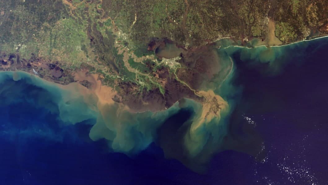
Each summer, the largest coastal dead zone in the United States develops along the Louisiana–Texas continental shelf. Nutrients carried by the Mississippi and Atchafalaya rivers stimulate biological production, while ocean circulation, water-column stratification and seafloor processes influence where oxygen is depleted. Although scientists understand many of these individual factors, predicting how they interact to control the size and persistence of the hypoxic zone remains challenging.
The project will address this challenge by developing a Multi-Architecture Physics-Informed Neural Network framework. The system will combine image-segmentation models, dynamic graph neural networks, high-resolution ocean-circulation simulations and ocean digital twins. Physical constraints governing water movement, oxygen transport, light attenuation and sediment oxygen consumption will be embedded directly into the AI framework.

A central innovation is the incorporation of measurements describing oxygen exchange between the seabed and overlying water. Sediment deposition, resuspension and oxygen consumption can strongly affect bottom-water oxygen levels, particularly during storms. Representing these processes more accurately could help researchers identify the mechanisms that cause hypoxic waters to form, spread and persist.
The team aims to produce forecasting tools that are faster than traditional numerical models while remaining physically consistent and scientifically interpretable. These tools could ultimately support fisheries management, nutrient-reduction planning and decision-making in Gulf Coast communities.
The project will also provide interdisciplinary training for graduate and undergraduate students in oceanography, coastal science and artificial intelligence. Educational materials will be shared through an AI-powered learning platform, and the team plans to release project data, software and trained models as open resources for the broader scientific community.
Learn more about the NC State award and the LSU collaborative award.

Related Posts